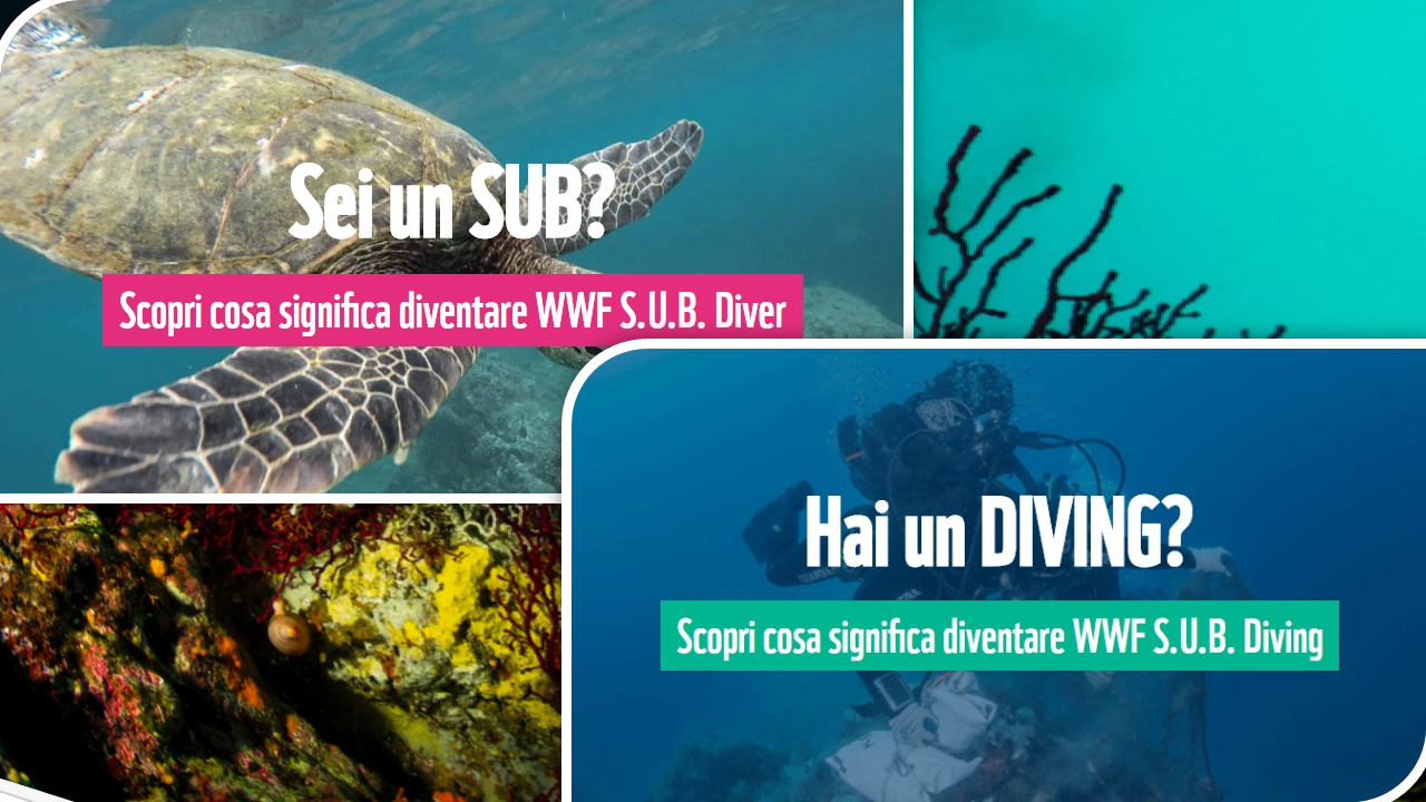
")


The patient work of the Forest has allowed a partial recovery of the wonderful forests that integrates with the unspoilt Mediterranean, smelling of a sea of thyme which is named the most remote and wildest of Egadi, the other the reconstruction of the ancient and forgotten “steps” that allowed the old Marettimo to cross over its entire length while the impervious island, He has enabled its full fruition.
Today the paths allow long and comfortable walks and excursions and a drive way makes it possible, moving from the small fishing village, along the coast almost to the Praia Nacche, pulling into the green of the maritime pine forests. If you go along the footpath, you can reach the other side of the island lighthouse, place about 40 mt. from the sea and continuing the walk you can appreciate the splendor of Cala Nera, closed by the small promontory of Punta Libeccio.
Very impressive walking routes leading towards South up over Punta Bassana, and from Southwest, from the beaches of Cala Conca and Galera.Due different routes cross the island to the north, of these one in North-West direction leads to the Roman houses, historical evidence of the Roman period around 300 mt. above sea level, and reaches Monte Falcone at Mt.. 686, the highest peak of the Aegean archipelago; the other path, from the village, always towards North, skirting up the coast and you can join the beautiful beaches in Lebanon and Scalo Maestro, then Punta Troia by its Spanish castle and former Arab-Norman watchtower. A little before, Contrada Rumurale, instead, continuing for the master track towards Northwest, you can walk along the top across the north coast of the island until you reach Punta Mugnone then immerse yourself in the beautiful waters of Cala Bianca. The front of the sea on the west of the island that runs from Cala Bianca Cala Nera is not accessible from the ground for the presence of Barranchi, great cliffs of dolomite rock that reach 400 mt. height on which it is possible to, for experts, moving from the sea to rock.
Particularly fascinating the boat trip around the island and offering a picturesque and varied coastline with the presence of numerous underwater caves, the water level and on the mountainside overlooking the sea and limestone gravel bottoms. Starting from the port to the north, meets the Cave of the Camel close to the homonymous rock and that of the Thunder in Punta Troy, immediately after the Cave of the Pipe. Continuing after Punta Mugnone and Cala Bianca, It is the Cave Mammarino, overcoming the tip of Octopus Head you get to Grotta Perciata and immediately after that of the Nativity. After Punta Pegna the Cave of Bombardella and Bombs. Further down, to the south in front of the beautiful Punta Martino Sommersa cave at a depth of about 30 mt.
Trekking routes in Marettimo (difficulty’ I – II e III grado)
First itinerary
Since Fosso Bonagia to gully Barranco, foreseeable time by 2,30 a 3 ore.
In Fosso Bonagia you see at the top a rock tower. Reach its base, where a wall of 10 mt. bars the way. Overcome it from left to right ( steps III) then climb another leap (II). At the fork take the gully on the right aiming at a large boulder characteristic; 30 mt. After you cut south (right) up to a saddle that connects the Fosso Bonagia with a secondary branch of the gully Barranco. Get off the latter, Then in the main to 50 mt, from the sea, where a ledge makes it possible to traverse to the South-West.
second itinerary
From Gully Barranco, to Punta Pegna Bay, foreseeable time by 1,30 a 2 ore
Follow the ledge, in a secondary channel to reach another 5 mt, above (II). Follow it as well as the terraces that follow (it passes under a monolith). Per roccette (I) in moist black niche, climb the wall 10 mt. to the left of the niche (III) and rocks on the right. Southbound (II) to the bottom Fossone Cats. You saie obliquely and for a channel it comes down to Punta Pegna Bay (cave).