")


During a hunting trip on the prairie between Levanzo and Favignana a group of humans approaches a deer that will be bordered by unaware in a small mirror of water. Suddenly a flock of birds gets up in flight; The deer escapes abruptly in the opposite direction, stands out a jump and fortunately dodged the arrows moving away. This time the fate was favorable to the deer, even if hunters will have the opportunity to try again.
It could have been concluded like this, circa 12.000 Years ago, a hunting scene that an observer could have scrutinized from above what today is the Monte Santa Caterina on the island of Favignana; Maybe to reproduce it later in artistic form, Through the caves and rock paintings, similar to those depicted in Grotta del Genovese Levanzo.
Sicily at that time was preparing to get out of the long glacial winter, lasted about 60.000 years, which he had held with a thick full of ice whole continents, lowering the sea level up to about 120-130 m below the current level. Favignana and Levanzo, then reachable on foot, They were an appendix of Sicily, while in the distance Marettimo emerged, majestic and lonely, from the sea.
We still have to wait a few thousand years before the sea, Following the global warming and subsequent widespread dissolution of the glaciers, reach the current level by surrounding Levanzo and Favignana.
And so already about 8.000 Years ago tuna benches, Also represented in the Genoese cave, driven by the unstoppable motion of the currents from the mouths of Gibraltar, they moved fast, without apparent effort, in the channel between Favignana and Levanzo, swimming on imposing forests made up of plants and marine algae which in the meantime colonized The shallow bottom of the archipelago, modeling them and contributing to the construction of a unique and inimitable submerged landscape.
Favignana, Levanzo and Marettimo, Puts west to the open sea, today they represent the outpost of the limestone reliefs of western Sicily e, Together with the islets of Formica and Maraone, they form the second group of Sicilian minor islands by extension.

Marettimo
Cited in antiquity by Polybius as He will nèsos (the sacred island), called Maritima by the Romans and subsequently Malitimah from the Arabs, The island of Marettimo, steep and wild, it is the most distant from the Sicilian coast. C
On the summit of Pizzo Falcone, which reaches almost 700 m, It is the highest in the entire Archipelago of the Egadi. The coast exposed to the west overflows overlooking the sea with high and imposing cliffs, against which the waves that unload the energy accumulated here after having traveled for hundreds of kilometers without finding any obstacles.
At the base of the limestone limestone small coves, bathed by turquoise and transparent waters, interrupt the continuity of the coastal profile and alternate with karst caves with evocative names (bombard, Perciata, Crib, etc.), where the nun seal is around and regularly nests one of the most mysterious marine birds, The bird of storms.
The interior is traveled by perfectly treated and reported paths and mule tracks, showing the least known aspect of the island. Innerpying in steep slopes, in a esplanade to about 250 m of altitude, appears in the locality "Romanian houses" a military building that is told was built as a lighthouse by Sesto Pompeo in 36 A.C.. Nearby, probably sheltered from the incursions of the pirates, It was erected by the Basilian monks of the Norman age (XI-XII century) A Byzantine church.
The climb to the top of Pizzo Falcone continues for about 2 ore, through steep slopes, Fitti woods and intense perfumes of thyme, Oregano and rosemary, spread by sudden and pleasant gusts of marine breeze. On the top, from a series of grassy crests, The surrounding landscape is dominated.
The glance is absolutely unique: turning the look lower, The promontory of Punta Troia in the north and Bassana tip to the south, immersed in a sea of a thousand shades, mark the limits of the eastern coast of the island. Here the houses of the only inhabited center are concentrated, the port of the fishermen and the latte of the hydrofoils. Looking in the direction of the Sicilian coast, the silhouettes of Favignana and Levanzo are recognized e, On clear days, Monte Erice ends in the distance whose summit hosts, protected by solid walls, The homonymous and famous medieval village.

Levanzo
With a surface just 6 kmq, Levanzo is the smallest of the Egadi islands. Call from the Greeks Phorbantia, probably for the abundant amount of grass, The island develops in length From Cala Dogana to Capo Grosso with a coastal profile reminiscent of a cusp addressed to the north. A population of about 200 inhabitants and the virtual absence of a road network (A single road crosses it from north to south) has allowed the island to maintain its integrity and a remarkable landscape beauty. Cala Dogana To the south it is a cove with crystal clear waters framed by the white houses of the inhabited center and partly protected by the small pier of the marina. To the west, Beyond Punta Pesce, Faraglione appears, A rocky rock meeting and home of a rowdy colony of seagulls. Still to the north the coast turns high and wild up to Punta del Genovese, where the grotto homonymous, One of the most important archaeological sites in Italy, with its engravings dating back to the last phase of the glacial era (circa 12.000 Years ago) and more recent rock paintings. Subsequently, the cliff is curious after the Sorci tip, opening up in the vast inlet of Cala Tramontana, Avoided in the sides by euphorbia cushions with cangiant shades, Associated in the lower stain with Cisto, thyme and helichrys.
Towards Capo Grosso, and beyond after having dubbed it, The coast presents itself with high cliffs overlooking the sea of extraordinary suggestion and beauty. QUete waters were theater in 241 A.C.. of an epic battle between the two superpowers of the world then known, Romans and Carthaginians. The clash ended the First Punic War, marked the decline of the Carthaginian power, He paved the way for the Roman Empire and probably decided not only the fate of the world of that time but also those of the centuries to come. Testimonies of this war event are the numerous archaeological finds, as still in lead strains and rostri Roman age, kept in the surrounding seabed Capo Grosso.

Ant and Maraone
Along the route that connects Levanzo to Trapani, Two small islets emerge from the submerged forests of Posidonia, Ant and Maraone, Components of law of the Egadi archipelago. The islet Maraone, completely uninhabited, is the smallest, while the islet Formica It is a handkerchief of land that has been inhabited over the centuries starting from the Phoenicians. Seat of ancient buildings that housed an old tonnara no longer active, the islet, private property, Today also houses a small museum, An ancient church of the '300, A Spanish castle in the restoration phase and the recovery community founded by Father Eigio.

Favignana
Favignana, la più grande delle isole Egadi, è una piattaforma calcarenitica interrotta nella parte centrale da una dorsale montuosa che con il Monte Santa Caterina supera di poco i 300 m di altezza. Una «farfalla sul mare» la definì, per la sua caratteristica forma, l’artista siciliano Salvatore Fiume in un famoso manifesto degli anni ‘70. Nota come Egusa dai latini per la cospicua presenza di capre, il nome attuale deriva dal Favonio, vento caldo che ne condiziona il clima mite.
Punta Sottile, la propaggine occidentale dell’isola, è presidiata da oltre 150 anni dall’omonimo faro che assolve, with its 48 m di altezza e il suo particolare apparato illuminante, il compito di indicare la rotta non solo alle imbarcazioni e alle navi ma anche agli aeromobili. Proseguendo sul lato meridionale, la costa mostra un profilo caratterizzato da cale quasi circolari (Cala Rotonda e Cala Grande), insenature sabbiose (Marasolo, Calamoni, Burrone, Cala d'Azur) isolotti rocciosi (Preveto, Galera and Galeotta), riparo di colonie di gabbiani.
Punta Marsala a sud e Punta Calarossa a nord delimitano la costa orientale dell’isola e custodiscono un vero tesoro ambientale e naturalistico dai forti contrasti: Cala Bue Marino un toponimo che lascia intendere come in passato gli avvistamenti della foca monaca fossero frequenti in quest’area.
Le acque fresche e cristalline antistanti la scogliera, battuta da forti correnti, e gli splendidi fondali, ricoperti da praterie di posidonia e lenti sabbiose coralline, si manifestano in tutte le varianti del turchese.
Nel vicino entroterra le caratteristiche architetture delle cave di calcarenite (impropriamente chiamata “tufo”) testimoniano il duro lavoro e la fatica di generazioni di isolani. Il materiale, estratto e tagliato in cantuni (blocchi), era commercializzato in tutta la Sicilia e nell’Africa Settentrionale. Alcune cave dismesse sono state nel tempo utilizzate dagli abitanti dell’isola come orti e giardini ipogei di straordinaria bellezza, e sono anche state destinate in tempi recenti ad alberghi, alloggi e aree espositive. Ancora oggi comunque i blocchi di questa pietra duttile continuano a vivere in opere d’artigianato, plasmate dalla passione di artisti locali. La costa settentrionale dell’isola si apre con la spiaggia rocciosa di Cala Rossa, sicuramente la più bella delle Eaadi e meta preferita di turisti e di viaggiatori.
Superata Punta San Nicola si apre una profonda insenatura che ospita il centro abitato di Favignana. Ad ovest si erge la scogliera alta e scoscesa di Punta Faraglione immersa nelle acque dello stretto canale che la separano da Levanzo.
Lo sfruttamento delle cave e la tonnara per la pesca del tonno hanno rappresentato le principali realtà economiche e produttive dell’isola. Descritta per la prima volta circa 2.500 anni fa e praticata dai Fenici, dai Cartaginesi e dai Romani, è agli Arabi che gli abitanti dell’isola devono l’organizzazione e l’efficienza della tonnara, come pure le parole e i canti che per secoli hanno cadenzato il duro e faticoso lavoro dei tonnaroti nei momenti finali della mattanza. I Florio trasformarono alla fine del 1800 la tonnara di Favignana in una fiorente attività industriale.
From the 2007 la tonnara non è più attiva. Gli antichi barconi neri e le ancore arrugginite non prenderanno, perhaps, mai più il mare, ma il ricordo storico e di tradizioni continua visitando lo straordinario edificio dello Stabilimento Florio, da poco restaurato e riadattato per esposizioni museali dedicate alla filiera del tonno.

The Marine Protected Area
L’ Marine Protected Area Aegadian, istituita CON D.M. of the 27 December 1991, comprende le isole di Favignana, Levanzo, Marettimo and the islets of Formica and Maraone. Persegue le finalità della tutela e valorizzazione dell’ambiente marino, la ricerca scientifica, l’educazione ambientale e la promozione dello sviluppo sostenibile. Con 53.992 ha e 74 km of coastline, è la riserva più grande d’Europa.
È suddivisa in quattro zone a differente livello di protezione.
La zona A di tutela integrale (2% della superficie totale) interessa il tratto di mare a ponente dell’Isola di Marettimo e lo specchio di mare che circonda Maraone. Vi sono consentite la balneazione e, previa autorizzazione, le visite guidate subacquee svolte dai centri di immersione residenti, la navigazione dei natanti dei residenti e le visite guidate a bordo delle unità navali degli operatori residenti.
La zona B di tutela generale (5% del totale) interessa il tratto di mare che circonda Punta Faraglione a Favignana, il lato ovest dell’Isola di Levanzo, lo specchio di mare che circonda l’isolotto di Formica e, a Marettimo, i due tratti di mare compresi tra P.ta Bassana e P.ta Libeccio e tra P.ta Mugnone e P.ta Troia. Vi sono consentite balneazione, libera navigazione a vela, remi, pedali o con propulsori elettrici, visite guidate subacquee svolte dai centri d’immersione residenti, immersioni subacquee previa autorizzazione. Sono anche consentite, previa autorizzazione, pesca ricreativa e pesca professionale artigianale, navigazione ancoraggio entro i 500 m dalla costa (a residenti ed equiparati), ormeggio alle unità a vela; oltre i 500 m è consentita la libera navigazione anche ai non residenti. Nella zona B di Marettimo entro i 500 m dalla costa sono autorizzate giornalmente alla navigazione e all’ancoraggio fino a 40 unità navali di proprietà di non residenti.
La zona C di tutela parziale (41% del total interessa i lati est di Levanzo e di Marettime tutta Favianana. Vi sono consentite balneazione, libera navigazione ed ancoraggio al di fuori dei fondali di interesse ambientale, visite guidate subacquee e, previa autorizzazione, immersioni individuali, mooring, pesca ricreativa (compreso prelievo dei ricci per i soli residenti) e piccola pesca professionale.
La zona D di protezione (52% del totale) comprende il restante tratto di mare tra le isole. Vi sono consentite, previa autorizzazione, anche le attività di pesca a strascico e a grande circuizione. In tutta l’area marina protetta è vietata la pesca subacquea in apnea e l’uso delle moto d’acqua.
I principali progetti realizzati dall’AMP
- Posizionamento di “dissuasori” antistrascico e ripopolanti, per ridurre lo strascico illegale sotto costa che danneggia i fondali;
- Istituzione di campi ormeggio, per evitare i danni ai fondali dovuti alle ancore delle barche da diporto, assicurando però la sosta nelle cale più belle:
- Progetto “Vedette del mare”, per il monitoraggio delle specie protette con il coinvolgimento dei pescatori locali;
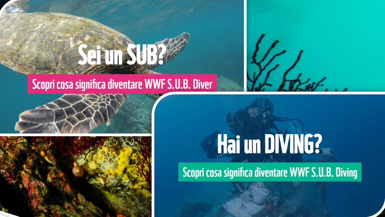
- Marchio per la certificazione ambientale dei servizi turistici (ricettività, ristorazione, noleggio, visite guidate, trasporto passeggeri, pescaturismo, diving), già rilasciato ad oltre 50 operatori;
- Osservatorio Foca Monaca nel Castello di Punta Troia a Marettimo;
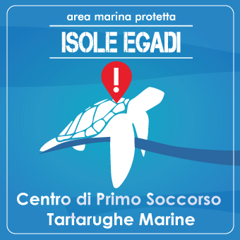
- Centro di primo soccorso per le tartarughe marine a Favignana;
- PON sicurezza per la videosorveglianza di tutto l’arcipelago;
- Progetti di ricerca e monitoraggio con ENEA, ISPRA e Università di Palermo;
- Informazione e prevenzione in mare, con 5 unità navali operanti tutti i giorni in estate;
- Guide dell’AMP sulle barche che effettuano trasporto passeggeri da e per le isole.
Per L’AMP lavorano in estate circa 35 persone, quasi tutti giovani laureati del posto o delle coste vicine.